Edith Grace Caufield

1-EdithCaufield-CO070-034Carrigaphooca castle (CO070-034), Macroom, Co. Cork viewed from the southeast. This view of the 15th century tower-house’s southeast corner illustrates the structure’s striking position atop a natural stone outcrop, sited just 100 meters north of the River Sullane. Several architectural features are similarly visible: the bartizan crowning the tower’s northeast corner (and the remains of a second bartizan at the southwest), a drip-stone at the foot of the tall window on the highest level of the south wall, and the battering of the castle towards its base are all prominent. These features likely had an important function during the tower-house’s life at the center of political affairs in the West Cork region during the turbulent 15th, 16th, and 17th centuries. Note the subtle separating of the masonry in the center of the east-facing wall’s base, in spite of the Office of Public Works’ monumental efforts in preserving the structure.

2-EdithCaufield-CO069-013
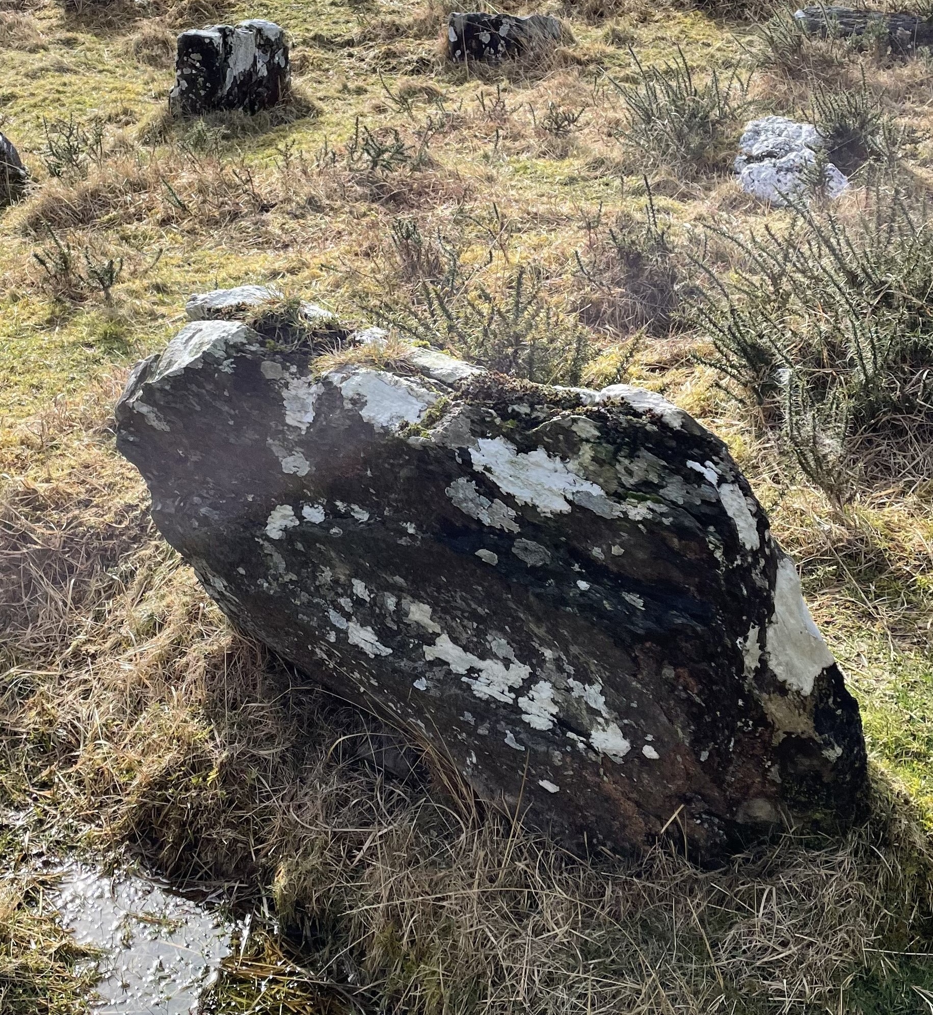
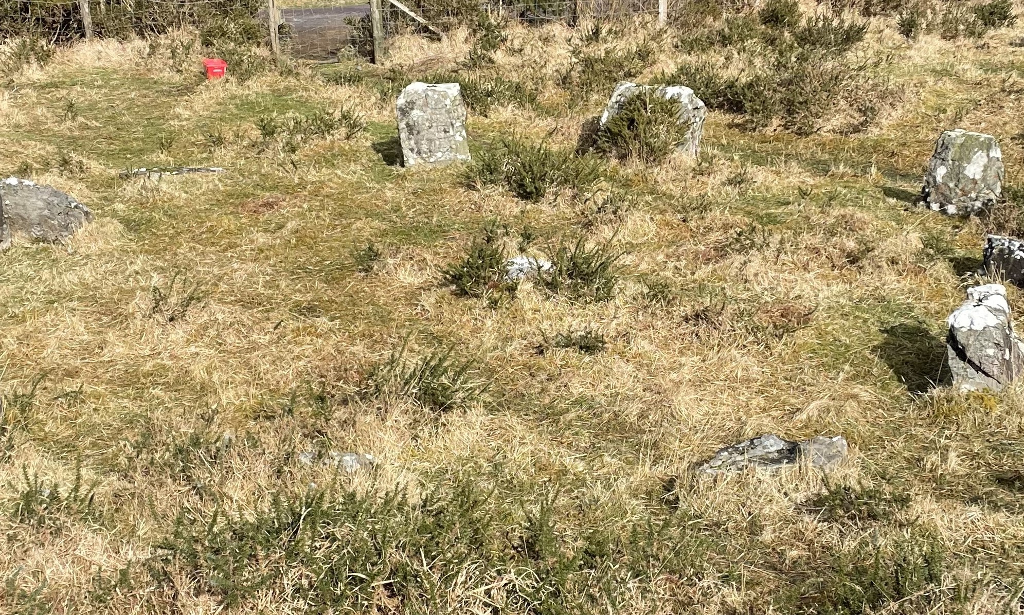
Gort An Imill stone circle (CO069-013), Rae na nDoirí, Co. Cork viewed from the south. This multiple-stone circle is typical of many in the southwest of Ireland in having an odd number of upright stones centered upon an axis that runs roughly northeast-southwest. 11 upright stones were present during our visit. The portal stones are the tallest stones visible in the center of the photo (the northernmost mostly obscured by the central figure), standing directly opposite the presumed axial stone, which is barely visible in the left-foreground of the image, mostly overgrown by grasses and gorse. Also present in the circle, and similarly obscured by gorse, is the “sunstone,” composed mostly of quartz, and also typical of many Cork and Kerry stone circles. Although the circle is practically invisible when viewed in the wider blanket bog-dominated landscape, the site itself commands an impressive view across the Douglas and Sullane river valleys towards the Derrynasaggart Mountains beyond.

3-EdithCaufield-CO069-017
Gortanacra/Rahoonagh West clapper bridge (CO069-017), Baile Mhic Íre, Co. Cork viewed from the northwest. This footbridge stretches across the River Douglas, bridging the townlands of Gortanacra and Rahoonagh West, and consists of stone slabs laid across rough masonry piers. It was excavated by a team of archaeologists in recent years, and subsequently reconstructed to reinforce it against collapse. The level of the bridge surface raises slightly along its length from the north end (foreground) to the south end (background). Four clapper bridges of similar construction are known from the surrounding region, and regular use of this bridge was recorded into the 20th century. A fording site on the river is located just a few meters to the west and is still in use for the moving of machinery and livestock across the river.

4-EdithCaufield-CO058-033
Site of the Gort na Tiobratan fulacht fiadh (CO058-033), Baile Bhuirne, Co. Cork viewed from the southeast. Little surface trace remains, but the stones labeled N through R by O’Kelly during excavation and reconstruction of the site in 1954 are presumed to be visible in the center background, heavily covered by moss and surrounded by bracken. This line of stone continues towards the scale-rod, left-center, as the edge of the feature labeled a “secondary hearth” in O’Kelly’s plan. The reconstructed “roasting pit” likely stretches into the dense bracken cover in the right-background. This overview gives a sense of the wet, boggy nature of the ground which would have been a requisite feature for the construction of a fulacht at this site.

5-EdithCaufield-CO058-034003
View of the chancel arch in Glebe medieval parish church (CO058-034003), also known as Teampall Gobhnatan, Baile Bhuirne, Co. Cork viewed from the west. This bluntly-pointed arch, located slightly off-center in the east gable wall, connects the nave of the original church to a chancel constructed at a later date. Near the pinnacle of the gable is a carved human head which projects out from the wall and is visible in the top-center; known in local tradition as “an gadaidhe dubh,” this head is likely a Romanesque voussoir, an architectural survivor from an earlier church which is thought to have existed on this site. Evident in the foreground of the photo and extending into the chancel are burials from the 18th through 20th century, extensions of the cemetery which surrounds the church.

Ailbhe Quain

1-Ailbhe Quain-CO070-034

Carrigaphooca tower house is believed to be constructed around 1436 by Donal MacCarthy.
Photo of the East facing wall displaying windows on each floor of the tower house. The castle had about 4 levels above ground level. The east facing wall has numerous windows to light up the straight stairwell. A bartizan can be seen in the North-East corner for defence. The window at the top is bigger to let more light in and there was less risk as it was higher up.

2-Ailbhe Quain-CO070-034

The south facing wall of Carrigaphooca castle. The garderobe can be seen on this side of the castle, unusually low. This is one of the weak points of the castle. The castle was constructed with split-stone masonry, with the corners being constructed from a more formal block. The quoins add ornament and structural integrity to the tower house.
A drip stone can be seen jutting out below the top window of the south-facing wall. This was for drainage.

3-Ailbhe Quain-CO069-013

Stone circle in Gort an Imil. Photo taken facing the north east. This is a non-prominent shielded stone circle, likely designed as a ritual site. There are 11 stones here, 9 of them make up the circle and the other 3 are loose stones not believed to be part of the stone circle.

4-Ailbhe Quain-CO069-017

Picture taken facing south of the reconstructed Clapper bridge in Rahoonagh. This was excavated about 10-15 years ago by Connie Kelleher. Constructed with support stones and long flat slabs along the top.
Believed to be 13-14th century, brought over by the Anglo-Normans. However, there is no dating evidence. It is a fragile monument built at the fording point.

5-Ailbhe Quain-CO058-034004

St.Gobnait’s grave in Glebe. The picture was taken facing North. The grave is made up of a mound and loose slab stones. Some slabs have a cross mark engraved into them. The indents in the slab at the bottom is where people believed St.Gobnait knelt. Her grave is part of a pilgrimage.

Ciara Leahy

1-Ciara Leahy-CO070-034

15th century tower house pictured from the south/east facing walls. Located in the Carrigaphooca townland, the five-storey castle has many defense features identifiable.
The remains of multiple bartizans are found on top of the NE and SW corners of the tower house. The east-facing wall presents many windows with the purpose of lighting the spiral staircase that give access to the different floors and garderobe. The tower house itself is positioned on a large mound of rock which is a defensive feature, and a set of steps has recently been installed for access to the castle.

2-Ciara Leahy-CO070-034

Ground floor window of the Carrigaphooca tower house. The south-facing window in this picture has a slight arch with clear evidence of architectural intelligence showing the wattle and daub-type material used to strengthen the window frame, with horizontally-placed slabs to thicken the structure.

3-Ciara Leahy-CO069-017

Gort an Acra/Rahoonagh West Clapper bridge pictured from the NW looking SE the clapper bridge lies on the river Douglas.

4-Ciara Leahy-CO058-034004

Penitential station pictured from the south, showing a mound, covered in sod, which is known to be St Gobnait’s grave. It is a station in the pilgrimage of St Gobnait and is marked with pilgrim crosses. There is a flat stone on the south-facing side for those who wish to kneel and pray as a part of their pilgrimage.

5-Ciara Leahy-CO069-013

Stone circle, located in the Carrigaphooca townland. Pictured from the south. Approximately 5.5 meters in diameter, it is no longer completely standing. Three stones still standing suggest an original diameter of at least 5.5 meters.

Jack Long

Jack Long-Co069-017
This site Is located southeast of Baleyvourney in the townland of Rahoonagh West. It is known as a clapper bridge. It is roughly 19 meters in length. This site was repaired and excavated by Connie Kelleher. Damage had been caused to this site as the volume of water changed in the river during different seasons causing the stone slates to be damaged and moved from their position.

Jack Long-Co069-013
This stone circle is found in the townland Gort an Imill. It is found near the top of mountainous ground. It has 9 stones all together. In the middle of the circle the stone is quartzite. It is roughly 7.5 meters in diameter. The highpoint of the hill is located just south of the stone circle.

Jack Long-Co070-034
This tower house is located in the area of Carrigaphooca. It is found on a rocky outcrop in a boggy area of land. There is also a defensive wall on the northwest side of the castle where there wasn’t as much rock to protect the castle. Works took place to preserve and repair this project. It was built in 1336 to 1351 by Donal MacCarthy. The structure of this castle is well preserved with an open top floor.

Jack Long-Co058-033

This Fulacht Fia is located in Gort Na Tiobratan. This site was first excavated in 1951. A small hut was also found to be close to this Fulacht Fia. it is located close toSt Gobnaits house roughly 200 meters away. The trough of the Fulacht Fia is 1.8 meters by 1 meter on a northwest to southeast axis.

Jack Long-Co058-034009
This site is located in the townland of Glede, southwest of Ballyvourney. It is a station on the St Gobnaits pilgrimage. People put belongings on a tree beside this well as well as drink the water from the well. It is thought that the water cures ailments that the person has. The well is found in a stone encasement.

Ruairí Falvey

1.Ruairí Falvey-CO070-034

This photo was taken on the 2/3/24@10:17, facing west.It Shows the eastern wall of carrigaphooca tower house.the rock outcrop the tower house is built directly onto is clearly visible.We can also see numerous windows,the three diagonal ones in centre frame indicating the straight flight stairs that gives access to the first few floors.In the top right of the tower the remains of the north eastern bartizan hang above the below doorway

2.Ruairí Falvey-CO069-013

This photo was taken on the 2/3/24@12:25,facing south west.It was taken at the stone circle in Gortanimill,west cork.In the centre of the frame it can be seen that the 2nd stone from the left aligns with a break in the stone at the centre of the stone circle.This is notable as this photo was taken on a sw/ne orientation which is the direction the sun rises from here.Compounding this there is a notch present on the stone aligning with the break (see photo 3).

3.Ruairí Falvey-CO069-013

This photo was taken on the 2/3/24@12:27,facing approx NE.In center frame there is a clear notch cut into the rock extending left, with potential tool marks visible on its upper side in this picture.This notch aligns with a crack in the central stone of the stone circle which may signify the notch was part denoting some form of solar activity, most likely a solstice of some kind.

4.Ruairí Falvey-CO058-034007

This photo was taken on 2/3/24@15:40,facing east.It overlooks what is now known as Saint Gobnait’s cemetery.In the background just left of center is the original medieval church and to its left is the 19th century neo gothic church built to continue use of the site.In center frame the mound where the people are praying is St Gobnait’s grave.

5.Ruairí Falvey-CO058-034007

This photo was taken on 2/3/24@15:15,facing north west.This picture is of the southern wall of the ruins of the medieval church that lay in saint gobnait’s cemetery.In it we can see the top of one of the church window which has a cusped ogee top.This top was carved out of one solid block.A figure has also been carved into the block most likely a “sheela na gig” although the lower section of the carving has been chipped away.

Benjamin Kingston

1-Benjamin Kingston-C0070-034

Carrigaphooca Castle, East Facing Wall

First site visited was Carrigaphooca Castle. The site category is Castle, more specifically a Tower House. It is situated on a sandstone outcrop, this decision to build on top of an outcrop has two main factors, firstly is that it is defensive as it makes the entrance harder to reach, secondly it protects from flooding as the surrounding area is a floodplain.

The photo is taken in a west-east direction. 275° West, magnetic compass. This wall has ten visible windows, most are narrow windows, arrow loops, with one larger window centered on the top floor which would have been the hall. This wall has more narrow windows as it is the wall with the stairwell built into it. This wall is the thinnest section to allow for the stairwell. The windows along the stairs would have provided light and acted as another defensive feature. On the top right corner there are the remains of bartizan. Bartizans give defenders more range of movement to defend against attackers against the wall.

2-Benjamin Kingston-C0070-034

Carrigaphooca Castle, Interior

The interior of Carrigaphooca has five floors with a vaulted ceiling which the hall sits upon. This would act as a fire break so that people could retreat to the hall in case of a fire in the lower floors. In the photograph you can see square holes in the wall, which would have been for wooden beams which would have held the weight of the second floor. It would have also helped to keep the stone work firm. On the first floor there is a vaulted opening before the window which would have been constructed using wicker to support the arched stonework until the key stone is added which makes the stone work ridgid.

3-Benjamin Kingston-C0069-013

Stone Circle

Photograph taken looking south, 160°, above the stone circle. There are 10 stones but a possible 11th stone was there. The center stone is white granite. The site is situated on a north facing boggy hillside. Height OD 210. Likely dating to the Iron Age, and is on a field boundary.

4-Benjamin Kingston-C0069-017

Rahoonagh West Clapper Bridge

Photograph taken looking South East, 137°. Eleven stone slab bridge which is crossing the river douglas. The slaps are supported by “eight rough masonry piers (H 0.9m)”. Thought to date to the 13th century, correlating with the arrival of the normans. The channel was narrowed during the excavation and rescue reconstruction in 2007, this put less pressure on the bridge but did shorten it.(https://excavations.ie/report/2007/Cork/0017267/ Visited: 08/03/2024)

5-Benjamin Kingston-CO058-034009

St Gobnait’s Well

A Holy Well, which is still used for votive offering, a part of the stations for Catholic Prayer, and the water is drunk for its healing properties. Photograph taken looking in a Northerly direction 354°.

The structure itself is made of stone with a lintel covering the well entrance. It is led down by stone steps. It is next to a tree which has rosary beads, ribbons which have a ritual association with Gobnait. The site is fenced in by an iron gage and stone corrabled wall.

Isabel Willats

1-Isabel Willats-CO070-034,This is a photograph of the South side of the castle building in Macroom, Cork. It is known as ‘CarrigaPhooca Castle’. 529236, 573435 ITM or 51.908558, -9.028478 Latitude and Longitude. 2/03/2024. Viewed from slight oblique.
Many windows are seen on this side as the orientation of the building allows for direct sunlight inside the rooms and upon the stairs. There are no chimneys so this is another reason for the number of windows.There are 5 storeys. It was built by Donal Macarthy in 1436.
The ruins once had a bawn and the stairs are replaced. It is a high fluvial area next to the River Suir surrounded by a lot of fields and on a rocky outcrop. The castle has a slightly battered wall, which functions as both defence and structure as the castle has no foundation other than the outcrop it sits on. At the very top, on the palisade, there is a bartisan above the North entrance. This functions as defence. It is split stone masonry.
The South side also has a garde robe and drip stone.
at the very top of the structure, the remnants of an alure walkway along the palisade is seen. These were generally made of wood so survival is rare.
In 1602, it was attacked and taken by O’Sullivan Bear.

2-Isabel Willats-CO070-034,
2/03/2024. viewed from internal oblique.
This is a photograph of the inside of the Macroom castle taken from the bottom floor.
The ceiling is corbelled and vaulted. This acts as a fire break in case of attackers. On the first floor there are keep holes in the walls for storage, this was mostly the servants area. The floor would have been covered with straw. Windows are South, West and East facing. Up to the 3rd floor, the staircase is straight, but from there up, it is spiral. There are segmental arches above the windows and the windows themselves are square set with wicker centering. Renne holes can be seen in the sides. On the 2nd floor, beam holes are seen to hold up the floor. The 2nd floor West window is a lintel led window and has a mural chamber embedded in its wall, this would have been a small bed room for staff. On the 3rd level, the North window is splayed and there’s a mural hallway to the garderobe in the South side.
On the top level, the main chambers, there is another, but larger, mural chamber in the West wall.

The OPW has done some work on the windows structure and the stairs.

3-Isabel Willats-CO070-035,
This is a photograph of a stone circle taken by above oblique angle. ITM 529476, 573550, and 51.909622, -9.025014 Latitude, Longitude. 2/03/2024.
North-East entrance, South-West axial stones. There are 10 stones but there could be more. 5.5 meter diameter.

4-Isabel Willats-CO058-033,
This is an image of a secondary Fulacht Fia. ITM 519977, 576917 and 51.938599, -9.163828 Latitude, Longitude. KilGobnet, Ballyvourney, Cork. 2/03/2024. Taken at an above oblique angle.
Excavated by M. J. Kelly 1951. Its function is accepted for cooking purposes as water for boiling is present along with small temporary wood based structure and charcoal. Excavation revealed a stone line trough and two hearths. The secondary hearth is more prominent than the primary. There is a wooden hut and a broken, burnt, stone midden. The trough is wedge shaped and 1.8 m in length, 1m width and 0.4 diameter. The trough is made of birch and oak. on the NW end, there’s an oak plank. moss and peat packing.The entry way for water is the SE end for the primary hearth. The secondary hearth replaced the primary hearth. 11 slabs with peat packing. The hut is SW from the trough. The way is lined by stepping stones as the ground is very wet and boggy. It is an oval shape surrounded by 10 wooden posts (5.6 meters long, 4 meters width), with an internal structure of four posts in a rectangle (2 meter length, 0.95 meter width). This a possible bed or preparation station. two post holes are a possible food rack (0.58 diameter). There were five stone discs and a pounder.

5-Isabel Willats-CO058-034007,
This is an image of the internal structure of St. Gobnait’s church (‘In Ruinatum’). ITM 519783, 576876 and 51.938202, -9.166639 Latitude, Longitude. 2/03/2024. viewed from an internal oblique angle of the East wall.
This is an Early Medieval church with East-West orientation in the East of the Glebeland. It is also known as ‘Teampall Gobnaten’. The graveyard itself has continuity of burial with the oldest in the South, this follows common tradition within medieval churches. There is gobnat imagery throughout the ‘Glebeland’ such as above the South entrance with a small ‘Sheela Na Gig’ on the wall of Gobnats body (CO058-034008) and inside above the romanesque arch separating the chancel from nave, a voussoir. In the graveyard outside, to the North of the church, is a grave in the shape of gobnait and on many of the graves gobnait is mentioned. in the church itself, the nave is 19.2 meters E-W, 9.25 meters N-S. The chancel is 8.55 meters E-W, 6.55 meters N-S. lintel windows on South and East walls.
to the West of the Glebeland, is a protestant church which is no longer in use.
The area is now a working graveyard and pilgrimage site with 5 stations. Participants ‘make the rounds’ at each of the stations following from a statue of St Gobnait to her burial place which is marked by a cross slab and the ruined church. ending at the holy well which is marked by a rag tree.
Associated sites include CO058-033, CO058-034009, CO058-034008, CO058-034003, CO058-034006, CO058-034005, CO058-034004, CO058-034011 and CO058-034001.

Caroline Fraher

1 – Caroline Fraher- CO070-034

Carrigaphooca Castle – Tower House – Visited on Saturday, 2nd March 2024.

Photo taken looking at the North-East corner of the castle. Visible in the photograph foreground is a landscape dotted with rock outcropping. From this distance we can see the tower house has been built directly onto a prominent mound of rock outcrop. This would have added greatly to the defence and protection of the tower. We can deduce from the number of windows on the East-facing wall that the tower house had five floors, as well as a staircase on this wall from the placement of some of the windows. Also visible from this vantage point is the remnant of a bartizan on the NE corner.

2 – Caroline Frahe – CO070-034

Carrigaphooca Castle – Tower House – visited on Saturday, 2ndMarch 2024.

This view is of the North-West corner of the tower. As illustrated we can clearly see black plastic coursing where the OPW has carried out works on this low wall. The wall has been built directly onto the outcrop, without foundations, similar to the tower itself. To the left of the wall the staircase up to the front door, which is on the North-facing wall, is visible. This staircase is not original to the tower, it was constructed during restoration works in the 1970s. From this angle we get a good view of what’s left of the two remaining bartizans, one on the NE corner, the other on the SW corner. We can also see the quoins and how impressively straight the walls of the tower are.

3 – Caroline Fraher – CO070-034

Carrigaphooca Castle – Tower House – visited on Saturday, 2nd March 2024.

This is an internal shot of the West wall, from the first floor to the roof. The picture shows three windows, slightly off-centre, but almost directly one above the other. The windows are recessed into the wall. We can see two different construction methods used in the framing of the windows. The bottom window in the photograph is the first floor window. The stone-lintelled embrasure acts almost as a landing into a small mural chamber to the right of the window. The second floor window opening is splayed and is larger than the first and fourth floor embrasures, but similar to the ground floor window (not in photo). It sits just above a ledge that would have held the wooden floorboards. This window is roofed using a segmental vault. To the right of this window we can see a type of cupboard (keep hole) built into the wall. The fourth floor window is splayed and lintelled. Also visible in the Southern internal wall are beam sockets and a corbel used to support floor beams. The vaulted stone ceiling can just about be made out.

4 – Caroline Fraher – CO070-034

Carrigaphooca Castle – Tower House – visited on Saturday, 2nd March 2024.

This photograph shows part of the roof of the ground floor window in the Southern wall of the tower. This is an example of the wicker pattern that would have been imprinted in the mortar once the wicker scaffolding was removed following construction. To the left of the window, in the corner just below the roof-line, is one of 3 holes on the east wall of the embrasure which would have held the wood used in the scaffolding. Just visible at the top of the photograph is the segmental vaulting that was used on a number of the windows in the tower. Wire mesh has been put on the windows to prevent birds from getting into the tower.

5 -Caroline Fraher – CO058-034007

St. Gobnait’s Church, Ballyvourney – visited on Saturday, 2nd March 2024. This is a photo of the chancel arch in the East gable wall in the nave of St. Gobnait’s Church in Ballyvourney. This is the West-facing side of this wall. We can see, high above the segmental archway, a very worn carved human head projecting from the wall. This head is known locally as ‘an Gadaidhe Dubh’ or ‘The Black Robber’. Local folklore tells us that the head depicts the face of a thief who had worked on the construction of the church. Legend has it that he intended on stealing the tools of his fellow craftsmen as well as St. Gobnait’s horse and to escape into the night. He was found the following morning stuck in an endless orbit of the church which was attributed to St. Gobnait herself. His image was immortalised in the stone head for everyone to see and know what he had done (https://irishheritagenews.ie/the-ballyvourney-thief-an-gadaidhe-dubh). It’s believed the head was once part of a Romanesque arch of an earlier 12th century church. Gravestones from more recent times now occupy the ruins of the church.

David Dockree

1-David Dockree-CO070-034Pictured, exterior west-facing wall of Carrigaphooca Castle (CO070-034). Positioned on top of a steep-sided rock outcrop, Carrigaphooca tower house consists of a total of five stories. The north-east and south-west corners of the top floor showcase the possible remnants of bartizans (small, protruding structure which served as a lookout or for defensive purposes). The tower house overlooks the River Sullane. Access to the ground-floor of the tower house is located on the north wall. This is permitted by the use of a staircase which was constructed by the Office of Public Works, during a restoration of the site. Photographed 2/03/2024.

2-David Dockree-CO070-034
Pictured, Carrigaphooca Castle (CO070-034) this time south-facing. Said to have been built in 1436 by Dermot Mor MacCarthy, Carrigaphooca Castle is noteworthy for being an early example of a castle building in the style of a tower house. A spiral staircase, beginning on the third-floor, grants one access to the rooftop. Photographed 2/03/2024.

3-David Dockree-CO058-033
Pictured, east-facing side of the secondary hearth of a fulacht fiadh that can be found in Gortnatubbrid (CO058-033). Intended uses for this site may have included, brewing, cooking, the boiling of water, or as a sweathouse. A burnt mound, a central trough, a primary and secondary hearth, a pit, and the remnants of a wigwam-like wooden structure were discovered during excavations. Photographed 2/03/2024.

4-David Dockree-CO069-017
Pictured, a clapper bridge (CO069-017) spanning the River Douglas, and comprising of eleven stone slabs which are supported by eight rough masonery piers. Several of the slabs toward the south-east end of the bridge have been claimed by the river. The image shows the north side of the bridge facing south. This particular bridge possible has its origins in the thirteenth century. Ireland has a sparse amount of these structures, with the majority of them being concentrated around the Cork area. Photographed 2/03/2024.

5-David Dockree-CO58-034009
Pictured, St. Gobnait’s Holy Well (CO058-034009) found south of the Ballyvourney graveyard. The site marks the endpoint of St. Gobnait’s pilgrimage, which begins in front of a statue of St. Gobnait. Pilgrims often drink from the well, and cups are often left behind for future particpants to take advantage of. Located beside the well is a rag tree (where little ribbons or strips of cloth are left as part of a healing ceremony, commonly by being tied to tree branches). Photographed 2/03/2024.

Deon Smith

1-Deon Smith-CO070-034

This photograph is of a five-story tower house situated in Carrigaphooca in Cork County. The photograph was taken on the east side of the tower house looking up at its position on a rock outcropping which is natural for the area. This angle of the castle shows its dominating position in the landscape as well as its bartizan which faces outward towards the open countryside. The photo was taken on the 2nd of March 2023 at 10:35 am.

2-Deon smith-CO056-034008

This photograph shows the carving of a woman exposing her privates which is situated on the South side of church CO058-034007, these are called Sheela na gig and what is interesting about this photo is that the block in which it was cut into belonged to another building and was removed and placed in its current location. Both for possibly the carving or the ogee design. The photo was taken on the 2nd of March 2023 at 15:15 pm.

3-Deon Smith-CO058-034007

The photograph taken here is the western face of the church of St Gobnet and it was built as a parish church for the saint covenant which is linked to a legend of the area. The structure takes a very stereotypical morphology and is akin to any other parish church in the area, although it can be seen that it is possibly built from stone from multiple structures, since some of the window heads have carved ogee blocks which are out of place along with a series of nonuniform coursework.The photo was taken on the 2nd of March 2023 at 15:34 pm.

4-Deon Smith-CO069-017

The picture here shows the reconstruction of a later medieval clapper bridge which by using 11 flat stones has made a passing over a natural ford. It was a part of both the ancient landscape as well as the recent community as people would use this point to cross over until a storm had toppled part of the bridge over, although the excavation and subsequent reconstruction have brought it back to its former position.The photo was taken on the 2nd of March 2023 at 12:40 pm.

5-Deon Smith-CO069-013

This is a photograph looking down on the south of the stone circle in the Douglas river valley. The monument consists of 11 stones with a stone of quarts inside the circle. The monument looks over the landscape since it is situated high on a hill. The location of the monument is boggy in nature which made traversing up to the monument difficult. The photo was taken on the 2nd of March 2023 at 12:17 pm.